Geocoders are applications that enable us to search for any location on the planet and get its coordinates. When we type the name of a restaurant into Google maps, Google’s geocoder has to find the coordinates of that place and only then can the maps app take us there.
How Geocoders work
At the heart of it all is a giant database keeping record of massive amount of geographical data. If you are curious look at this video by one of the mainainters of OpenStreetMap
Hosting your own geocoder
Thanks to the generosity of the open-source community, we have OpenStreetMap data that is kept up-to-date with the real world by the power of volunteers.
We can use that data for many things, but for creating a geocoder server we are extra lucky since the same open-source community has given us several geocoder applications to choose from. The most popular choice is Nominatim but other options include Pelias and Photon
Most applications have docker containers available so you can get up and running without going through a detailed installation process.
Caution
So far, everything I have told you sound very good. Almost too good to be true! Here is the catch: in order to deploy a geocoder that can cover the entire planet, you will need a machine with server specs 😱
As an example, here is what Nominatim wants in order to cover the planet:
A minimum of 2GB of RAM is required or installation will fail. For a full planet import 128GB of RAM or more are strongly recommended. Do not report out of memory problems if you have less than 64GB RAM.
But we can still download a piece of the data, maybe for one country and play with it>
Running Nominatim
Firstly, we will be using a docker image of the server so you must install docker on your machine. Our second task is downloading a dataset that will not cause the server to swallow our RAM. luckily, the OSM data is devided by country and served on this site
Here is what to do in order to start the server:
- clone the Nominatim Github repo and
cdinto the latest version directory (for me it is v4.1):
git clone git@github.com:mediagis/nominatim-docker.git
cd nominatim-docker/4.1/
- Inside, you will find a
readmefile with instructions on how to start the container. For version 4.1 it gives the following command:
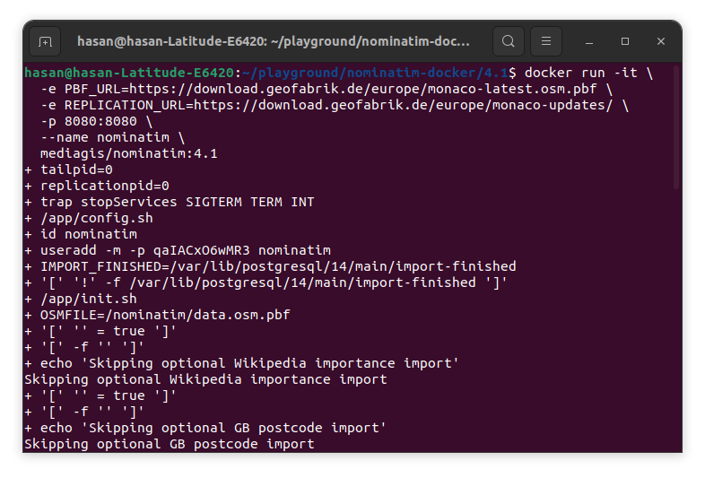
docker run -it \
  -e PBF_URL=https://download.geofabrik.de/europe/monaco-latest.osm.pbf \
  -e REPLICATION_URL=https://download.geofabrik.de/europe/monaco-updates/ \
  -p 8080:8080 \
  --name nominatim \
  mediagis/nominatim:4.1
The above command uses PBF_URL argument to give the container a URL to the dataset. In this case it is the dataset of Monaco, a small country in Europe.

The container will load the data and start the server. At that point you can use the server by way of its API
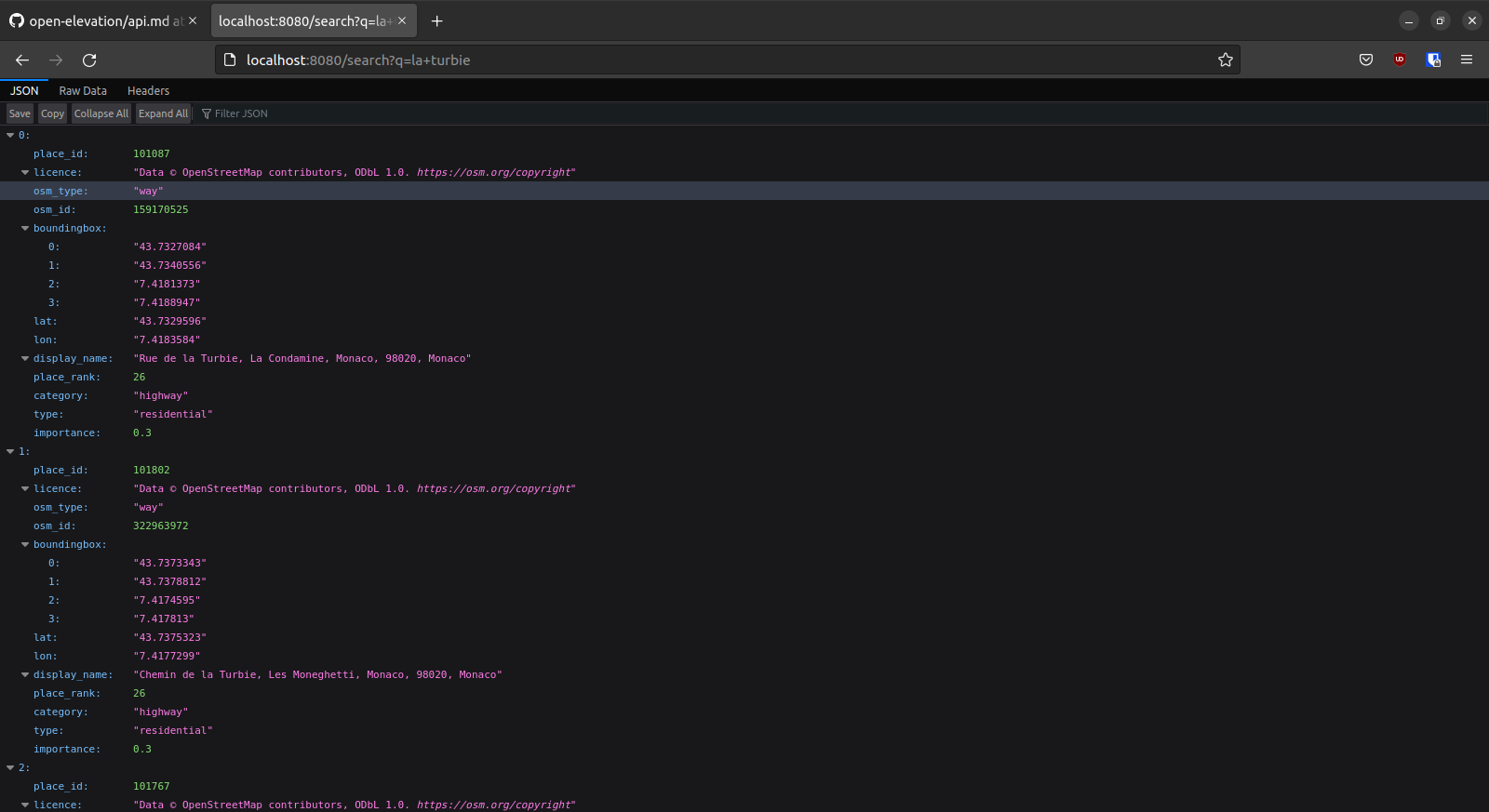
Here is an example request:
http://localhost:8080/search?q=la+turbie
Here, we are using the q= argument which stands for query. we are searching for “la turbie” which is a place in Monaco.
To send this request to the server you can use a tool like Postman or simply open a browser tab and visit the above link.
